Status Yellow Thunderstorm Warning: Travel Disruption Expected Across North-Western Counties
As we navigate the unpredictable weather patterns of 2026, the Irish landscape has once again been hit by volatile atmospheric conditions. Met Éireann has officially issued a Status Yellow thunderstorm warning for specific north-western counties, urging residents and commuters to exercise extreme caution as the system tracks across the region. With sudden shifts in weather becoming a frequent occurrence, staying informed is the best way to mitigate risks associated with lightning, flash flooding, and hazardous driving conditions.
Current Weather Alert: What You Need to Know
The latest meteorological data confirms that Donegal, Sligo, Leitrim, and Roscommon are currently under an active Status Yellow alert. These warnings are designed to alert the public to weather conditions that do not pose a threat to the general population but may cause localized issues for those in exposed locations or those planning travel.
The primary concern for meteorologists is the development of scattered thunderstorms that can strike with little warning. Unlike large-scale frontal systems, these cells are localized, meaning one town might experience heavy rain while a neighboring area remains relatively dry. However, the intensity of these localized bursts can be severe, leading to dangerous conditions on the road.
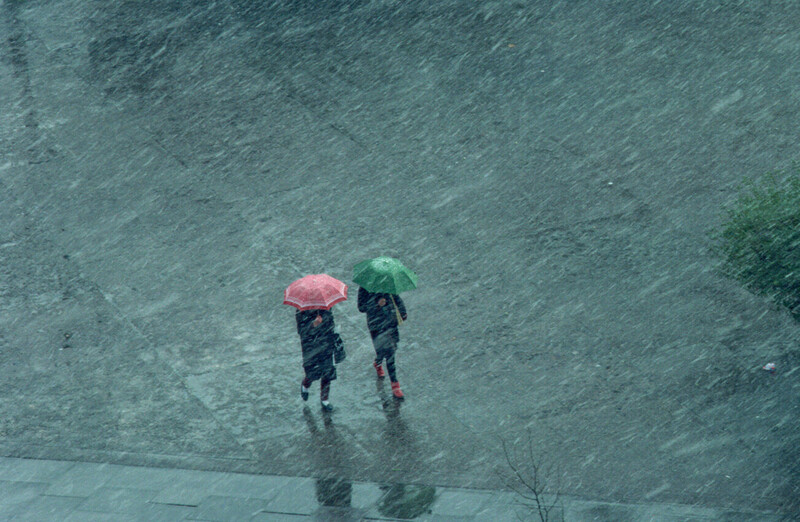
Expected Impacts on Daily Life
Forecasters have highlighted several key hazards that could arise during this warning period:
Localized Spot Flooding: Heavy rainfall in short bursts can overwhelm drainage systems, leading to surface water on local roads.
Lightning Activity: Potential for damage to electrical infrastructure, which may lead to temporary power outages in rural areas.
Difficult Travel Conditions: Reduced visibility and aquaplaning risks are high for anyone driving during the peak of the storm.
Dangerous Outdoor Conditions: Those working or recreating outdoors are advised to seek shelter if they hear thunder, as lightning strikes can occur even at a distance from the core storm cell.
Understanding Status Yellow Warnings in 2026
In the context of modern meteorological reporting, a Status Yellow warning serves as an “awareness” alert. While it does not imply the widespread destruction associated with higher-tier warnings (such as Orange or Red), it is a vital indicator that the weather is deviating from the seasonal norm.
For the north-west of Ireland, which is often exposed to Atlantic weather fronts, these thunderstorms can be particularly disruptive. The rapid cooling of the air combined with rising humidity levels creates the perfect “recipe” for the instability we are seeing today.
Why the North-West is Vulnerable
The geographic profile of the north-west—featuring rugged coastlines and elevated terrain—often acts as a catalyst for convective weather. When moist air from the Atlantic hits the rising topography, it forces the air upward, cooling it rapidly and forming the towering cumulonimbus clouds that produce lightning and heavy downpours.
Safety Advice: Navigating the Storm
Preparation is the most effective tool against weather-related incidents. Whether you are at home or on the road, following these guidelines can help keep you and your family safe during this thunderstorm window.
Road Safety Tips
If you must travel during the active warning period, prioritize the following:
- Reduce Speed: Aquaplaning is a significant risk. Slowing down allows your tires to maintain better contact with the road surface.
- Increase Following Distance: Stopping distances are significantly longer on wet roads. Give the vehicle in front of you extra space.
- Use Fog/Dipped Lights: Ensure you are visible to other drivers, even if it is not fully dark, as heavy rain obscures vision.
- Avoid Flooded Roads: Never attempt to drive through standing water unless you are certain of the depth. It only takes a small amount of water to stall an engine or cause a vehicle to lose traction.
Home and Property Protection
To protect your home from the potential effects of lightning and power surges:
Unplug Sensitive Electronics: During a thunderstorm, unplug computers, televisions, and gaming consoles to prevent damage from power surges.
Clear Gutters: If you have time before the storm hits, ensure your gutters are clear of debris to allow for efficient drainage.
- Secure Outdoor Items: High winds associated with thunderstorm cells can turn garden furniture or loose items into projectiles. Bring them inside or secure them firmly.
Looking Ahead: Monitoring the Forecast
As the 2026 season progresses, the frequency of these “flash” weather events appears to be increasing. Met Éireann recommends that the public checks the official weather updates frequently, especially when planning travel.
The current warning is scheduled to lift at 6:00 p.m. this evening. However, weather systems are notoriously difficult to predict with 100% accuracy, and it is possible for conditions to linger beyond the initial forecast window. Keep an eye on the official Met Éireann website or their social media channels for real-time updates regarding the cancellation or extension of the current alert.
Conclusion
While a Status Yellow thunderstorm warning for the north-western counties is a common feature of our climate, it should never be ignored. The combination of lightning, potential power interruptions, and poor driving conditions requires vigilance. By staying updated through reliable meteorological sources, adjusting travel plans, and taking basic precautions at home, you can navigate these stormy hours safely.
Remember, the weather can change in an instant—be prepared, stay informed, and prioritize your safety above all else. As we move into the evening, the risk of convective activity will likely subside, but until the warning is officially lifted, treat every dark cloud with caution.